|
|
|
Advertisements:
TransportationAirports
15 (2012)
Airports - with paved runways
Total 13
2,438 to 3,047 m 6 1,524 to 2,437 m 3 914 to 1,523 m 3 Under 914 m 1 (2012) Airports - with unpaved runways
Total 2
Under 914 m 2 (2012) Heliports
9 (2012)
Pipelines
Oil 0 km
Roadways
Total 14,671 km
12.321 km unter der Kontrolle der Regierung (mit 257 km Schnellstraßen) 2.350 km vom türkischen Zyprioten (2008) Merchant marine
Total 838
By type Massen-Träger 278, Fracht 163, Chemikalientanker 77, Container 201, Flüssiggas 11, Beifahrer 3, Passagier/Fracht 25, Öltanker 62, gekühlte Fracht 5, roll on / roll Weg 9, Fahrzeug Träger 4 Foreign-owned 622 (Angola 1, 1 Belgien 3, Bermuda 1, Kanada 2, China 6, 6, Estland 6, 16, 192, 201, Hong Kong 2, Indien 4, Iran 10, Irland 3, 6, Italien Griechenland Deutschland Frankreich Dänemark Japan 16, Niederlande 23, Norwegen 14, Philippinen 1, Polen 24, Portugal 2, Russland 46, 1, 5, 6, 5, Türkei 1, UAE 3, UK 7 Schweden Spanien Slowenien SingapurUkraine 3, US 5) Registered in other countries 152 (Bahamas 23, Kambodscha 4, Komoren 2, Finnland 1, Gibraltar 1, Griechenland 3, Hongkong 3, Liberia 9, Malta 32, Marshall-Inseln 40, Norwegen 1, Panama 5, Russland 13, St. Vincent und die Grenadinen 3, Sierra Leone 2, Singapur 6, unbekannte 4) (2010) Ports and terminals
Gebiet unter Kontrolle der Regierung: Larnaca, Limassol, Vasilikos; Bereich von türkischen Zyprioten verwaltet: Famagusta, Kyrenia
Anmerkungen
Neue Anmerkung hinfugen: |
Advertisement
Login
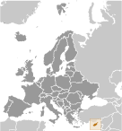
Zypern (Nicosia):
 
GPS-Punkte in Zypern (Nicosia)
|
||||||||

 Eine ehemalige britische Kolonie wurde Zypern unabhängig 1960 nach Jahren des Widerstands an britische Herrschaft. Spannungen zwischen der griechisch-zypriotische Mehrheit und der türkisch-zyprischen Minderheit spitzte sich im Dezember 1963, als Gewalt in der Hauptstadt Nikosia ausbrach. Trotz der Bereitstellung von UN-Friedenstruppen in 1964 setzte sporadisch interkommunalen Gewalt zwingen die meisten türkischen Zyprioten in Enklaven auf der ganzen Insel. 1974 Traf ein griechische Regierung geförderte Versuch, Kontrolle von Zypern zu ergreifen auf militärische Intervention aus der Türkei, die bald mehr als ein Drittel der Insel kontrolliert. In 1983 das türkisch-zypriotische besetzten Gebiet erklärte sich die "türkische Republik Nordzypern" ("türkische Republik Nordzypern"), aber es ist nur von der Türkei anerkannt. Die Wahl eines neuen zypriotischen Präsidenten im Jahr 2008 war der Anstoß für die UNO den griechisch-zyprischen und der türkisch-zypriotischen Gemeinschaften fördern Vereinigung Verhandlungen erneut öffnen. Im September 2008 begannen die Führer der beiden Gemeinschaften Verhandlungen unter Schirmherrschaft der Vereinten Nationen zur Wiedervereinigung der geteilten Insel. Die Gespräche sind im Gange und die Führer weiterhin regelmäßig treffen. Die ganze Insel hat die EU am 1. Mai 2004, obwohl den EU-Acquis - der Körper der gemeinsamen Rechte und Pflichten - nur für die Gebiete im Rahmen der international anerkannten Regierung gilt, und, in den Bereichen, die von türkischen Zyprioten verwaltet angehalten wird. Jedoch genießen einzelne türkische Zyprioten, die ihren Anspruch auf die Staatsbürgerschaft der Republik Zypern rechtlich dokumentieren die gleichen Rechte, die den anderen Bürgern der Mitgliedstaaten der Europäischen Union.