|
|
|
Advertisements:
GeographyLocation
Westeuropa, angrenzend an der Nordsee, zwischen Belgien und Deutschland Geographic coordinates
52 30 N, 5 45 E
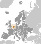
Map references
Europa
Area
Total 41,543 sq km
Land 33,893 sq km Water 7,650 sq km Area - comparative
Etwas weniger als zweimal die Größe von New Jersey Land boundaries
Total 1,027 km
Border countries Belgium 450 km, Germany 577 km Coastline
451 km
Maritime claims
Territorial sea 12 nm
Contiguous zone 24 nm Exclusive fishing zone 200 nm Climate
Gemäßigt; Marine; kühlen Sommern und milden Wintern Terrain
überwiegend küstennahen Tiefland und trockengelegte (Polder); einige Hügel im Südosten Elevation extremes
Lowest point Zuidplaspolder -7 m
Highest point Mount Scenery 862 m (on the island of Saba in the Caribbean, now considered an integral part of the Netherlands following the dissolution of the Netherlands Antilles) Note Der höchste Punkt auf kontinentalen Niederlande ist Vaalserberg 322 m Natural resources
Erdgas, Erdöl, Torf, Kalkstein, Salz, Sand und Kies, Ackerland Land use
Arable land 21.96%
Permanent crops 0.77% Other 77.27% (2005) Irrigated land
4,600 sq km (2003)
Total renewable water resources
89.7 cu km (2005)
Freshwater withdrawal (domestic/industrial/agricultural)
Total 8.86 cu km/yr (6%/60%/34%)
Per capita 544 cu m/yr (2001) Natural hazards
Flooding
Environment - current issues
Wasserverschmutzung in Form von Schwermetalle, organische Verbindungen und Nährstoffen wie Nitrate und Phosphate; Luftverunreinigung durch Fahrzeuge und Raffination Aktivitäten; saurer Regen Environment - international agreements
Party to
Luftverschmutzung, Luft Verunreinigung-Stickstoff Oxide, Air Pollution-persistente organische Schadstoffe, Luft Verunreinigung-Schwefel 85, Luft Verunreinigung-Schwefel 94, Air Pollution flüchtige organische Verbindungen, Antarktis-Umwelt-Protokoll, Antarctic Marine Living Resources, Antarktisvertrag, Biodiversität, Klimawandel, Klima ändern-Kyoto-Protokoll, Wüstenbildung, gefährdete Arten, Umwelt Änderung, gefährliche Abfälle, Gesetz des Meeres, Marine Dumping, Meeresschutz Leben, Schutz der Ozonschicht, Schiff Verunreinigung, Tropenholz 83, tropisches Bauholz 94, Feuchtgebiete, Walfang Signed, but not ratified Keines der ausgewählten Abkommen Geography - note
Am Mund der drei großen europäischen Flüsse (Rhein, Maas oder Maas und Schelde)
Anmerkungen
Neue Anmerkung hinfugen: |
Advertisement
Login
Niederlande (Amsterdam):
 
GPS-Punkte in Niederlande (Amsterdam)
|
||||||||

 Der Niederländer Vereinigten Provinzen erklärten ihre Unabhängigkeit von Spanien im Jahre 1579; während des 17. Jahrhunderts wurde sie ein führender Seefahrt und Handelsmacht, mit Siedlungen und Kolonien auf der ganzen Welt. Nach einer 20-jährigen französischen Besetzung wurde ein Königreich der Niederlande 1815 gebildet. 1830 Belgien abgefallen und gründete ein eigenes Königtum. Die Niederlande blieben im ersten Weltkrieg, aber erlittenes Invasion und Besetzung durch Deutschland im zweiten Weltkrieg neutral. Eine moderne, industrialisierte Nation, Niederlande ist auch ein großer Exporteur von landwirtschaftlichen Erzeugnissen. Das Land war ein Gründungsmitglied der NATO und der EWG (heute EU) und die Einführung des Euro 1999 beteiligt. Im Oktober 2010 der ehemaligen niederländischen Antillen aufgelöst, und die drei kleinsten Inseln-Bonaire, Sint Eustatius und Saba wurde spezielle Stadtbezirke in den Niederlanden Verwaltungsstruktur. Die größeren Inseln von Sint Maarten und Curaçao trat den Niederlanden und Aruba als konstituierende Länder bilden das Königreich der Niederlande.