English   Română   Español   Français   Deutsch  

getamap.net

Afrika

Ozeanien

Asien

Nordamerika

Europa

Sudamerika

Antarktis


53°57'43" S
37°29'20" W
~0m asl
12:28 (GST - UTC/GMT--2)

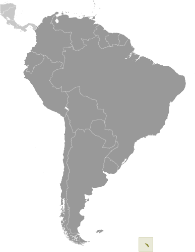
High Rock (High Rock) ist ein/eine Rock (class T - Hypsographic) in South Georgia and the South Sandwich Islands (general) (South Georgia and The South Sandwich Islands (general)), Südgeorgien Und Die Südlichen Sandwichinseln [ Germany ] (Antarctica), mit der Regionkennziffer Americas/Western Europe...

Die geographischen Koordinaten sind 53°57'43" S und 37°29'20" W im DMS-Format (Grad/Minuten/Sekunden) oder -53.9619 und -37.4889 (in Dezimalgrad). Die UTM-Lage ist WF91 und die Joint Operation Graphics Referenz ist SN24-06.

Die aktuelle Ortszeit ist 12:28; die Sonne geht um 08:54 Uhr auf und um 21:01 Uhr unter (Atlantic/South_Georgia UTC/GMT-2) (die genannten Zeiten sind Ortszeiten). Die Zeitzone für High Rock ist UTC/GMT-2
Im Jahre 2024 gilt die Sommerzeit vom - bis am -.

A Rock ist sichtbar, isoliert Felsmasse.


Country
 Advertisements:


 Advertisements:


Wetter High Rock (Bewölkung, Temperatur, Windgeschwindigkeit und Niederschlag mm probab.)

Thu


Apr 25
Clound 0-40-10-0 Mist
 
-1 °C min
1 °C max
25 km/h
Thu Jan 1

Fri


Apr 26
Clound 10-90-50-50 Mist
~4 l/m2 74%
 
2 °C min
3 °C max
20 km/h
Thu Jan 1

Sat


Apr 27
Clound 20-100-60-70 Mist
~22 l/m2 97%
 
2 °C min
5 °C max
48 km/h
Thu Jan 1

Sun


Apr 28
Clound 0-50-60-50 Mist
~3 l/m2 70%
 
1 °C min
3 °C max
25 km/h
Thu Jan 1

Mon


Apr 29
Clound 0-100-60-0 Mist
~35 l/m2 97%
 
1 °C min
3 °C max
25 km/h
Thu Jan 1

Tue


Apr 30
Clound 10-80-70-50 Mist
~16 l/m2 97%
 
1 °C min
3 °C max
24 km/h
Thu Jan 1

Wetter Graph

High Rock (South Georgia and the South Sandwich Islands (general)) 7 Tage Wettervorhersage
 

Karte und Photos High Rock


Anmerkungen

--- Es gibt noch keine Anmerkungen ---


Neue Anmerkung hinfugen:


Sie mussen sich anmelden, um eine Anmerkung hinzufugen!


Login


Register

Passwort vergessen?

Südgeorgien Und Die Südlichen Sandwichinseln [ Germany ] (Overseas Territory):

Advertisement


GPS-Punkte der nahe von High Rock


square Sky Rock (2 km)


square Rosita Harbor (6 km)


square Koppervick (6 km)

square Koppervik (6 km)

square Buller Bay (6 km)

square Sitka Bay (6 km)

square Ram Head (7 km)

square Cape Buller (8 km)

square Wales Head (8 km)

square Pyramid Peak (8 km)

square Camp Bay (8 km)

square Shag Point (8 km)


GPS-Punkte in Südgeorgien Und Die Südlichen Sandwichinseln [ Germany ] (Overseas Territory)

square Brunonia Glacier South Georgia And The South Sandwich Islands (general)

square Larsen Point South Georgia And The South Sandwich Islands (general)

square Moraine Fjord South Georgia And The South Sandwich Islands (general)

square Miles Bay South Georgia And The South Sandwich Islands (general)

square Antarctic Bay South Georgia And The South Sandwich Islands (general)

square Sandwich Islands South Georgia And The South Sandwich Islands (general)

square Thule Island South Georgia And The South Sandwich Islands (general)

square O'conner Peak South Georgia And The South Sandwich Islands (general)


viewweather.com sv.ViewWeather.com
fr.ViewWeather.com
da.ViewWeather.com
de.ViewWeather.com
es.ViewWeather.com
www.carpati.org
www.searchromania.net
Deblocari usi
es.getamap.org
fr.getamap.org
de.getamap.org
nl.getamap.org
da.getamap.org
www.getamap.org
Links
Nutzungsbedingungen
Datenschutz

# 0.0634 sec 

contact AT getamap.net

© 2006 - 2024  https://de.getamap.net/