|
|
|
Advertisements:
TransportationAirports
43 (2012)
Airports - with paved runways
Total 6
2,438 to 3,047 m 1 914 to 1,523 m 2 Under 914 m 3 (2012) Airports - with unpaved runways
Total 37
2,438 to 3,047 m 1 914 to 1,523 m 10 Under 914 m 26 (2012) Roadways
Total 3,007 km
Paved 575 km Unpaved 2.432 km (2006) Waterways
825 km (nur durch kleine Boote schiffbar) (2011) Merchant marine
Total 247
By type Träger 1, 33-Massengutfrachter, Fracht 156, Chemikalientanker 2, Flüssiggas 1, Passagier/Fracht 4, Öltanker 9, gekühlte Fracht 30 Lastkahn, roll on / roll Weg 10, spezielle Tankwagen 1 Foreign-owned 152 (1, China 61, 1, 1, Griechenland 2, Island 1, Italien 3, 9, 1, Niederlande 1, Norwegen 2, 30, Singapur 4, Schweiz 1, Syrien 4, Thailand 1, Türkei 16, UAE 3, UK 4, Ukraine 6 Russland Litauen Lettland Estland Kroatien Bulgarien) (2010) Ports and terminals
Belize City, große Creek
Anmerkungen
Neue Anmerkung hinfugen: |
Advertisement
Login
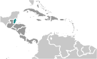
Belize (Belmopan):
 
GPS-Punkte in Belize (Belmopan)
|
||||||||

 Belize war die Seite mehrere Maya Stadtstaaten bis ihren Niedergang am Ende des ersten Jahrtausends A.D. Die britischen und spanischen umstritten die Region im 17. und 18. Jahrhundert; 1854 wurde formal der Kolonie Britisch-Honduras. Territorialstreitigkeiten zwischen Großbritannien und Guatemala verzögert die Unabhängigkeit von Belize bis 1981. Guatemala weigerte sich bis 1992 die neue Nation zu erkennen und die beiden Länder eine laufende Randdebatte beteiligt sind. Guatemala und Belize planen, halten eine gleichzeitige Volksabstimmung zu bestimmen, ob dieser Streit wird vor den internationalen Gerichtshof in den Haag, gehen, obwohl sie noch nicht auf ein Datum festgelegt haben. Tourismus ist die Hauptstütze der Wirtschaft geworden. Aktuelle Anliegen umfassen des Landes schwere ausländischen Schuldenlast, hohe Arbeitslosigkeit, wachsende Beteiligung an der mexikanischen und südamerikanischen Drogenhandel, Hohe Kriminalitätsraten und eine der höchsten Prävalenz von HIV/AIDS in Mittelamerika.