|
|
Advertisements:
GeographyLocation
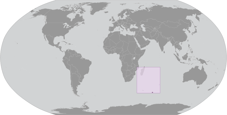
In der Nähe südöstlich und östlich von Afrika, Inseln im südlichen Indischen Ozean, einige von Madagaskar und andere über äquidistant zwischen Afrika, Antarktis und Australien; Hinweis - Französische Süd- und Antarktisgebiete gehören Ile Amsterdam, Ile Saint-Paul, Iles Crozet, Iles Kerguelen Bassas da India, Europa Island, Glorieuses, Juan de Nova Island und Tromelin Insel im südlichen Indischen Ozean, zusammen mit der französischen behauptete Sektor der Antarktis, "Adelie Land"; der USA erkennt nicht den französischen Anspruch auf "Adelie-Land" Geographic coordinates
Ile Amsterdam (Ile Amsterdam et Ile Saint-Paul) 37 50 S, 77 32 E
Ile Saint-Paul (Ile Amsterdam et Ile Saint-Paul) 38 72 S, 77 53 E Iles Crozet 46 25 S, 51 00 E Iles Kerguelen 49 15 S, 69 35 E Bassas da India (Iles Eparses) 21 30 S, 39 50 E Europa Island (Iles Eparses) 22 20 S, 40 22 E Glorioso Islands (Iles Eparses) 11 30 S, 47 20 E Juan de Nova Island (Iles Eparses) 17 03 S, 42 45 E Tromelin Island (Iles Eparses) 15 52 S, 54 25 E Map references
Antarktische Region
Area
Ile Amsterdam (Ile Amsterdam et Ile Saint-Paul)
Total - 55 sq km; land - 55 sq km; water - 0 sq km Ile Saint-Paul (Ile Amsterdam et Ile Saint-Paul) Total - 7 sq km; land - 7 sq km; water - 0 sq km Iles Crozet Total - 352 sq km; land - 352 sq km; water - 0 sq km Iles Kerguelen Total - 7,215 sq km; land - 7,215 sq km; water - 0 sq km Bassas da India (Iles Eparses) Total - 80 sq km; land - 0.2 sq km; water - 79.8 sq km (lagoon) Europa Island (Iles Eparses) Total - 28 sq km; land - 28 sq km; water - 0 sq km Glorioso Islands (Iles Eparses) Total - 5 sq km; land - 5 sq km; water - 0 sq km Juan de Nova Island (Iles Eparses) Total - 4.4 sq km; land - 4.4 sq km; water - 0 sq km Tromelin Island (Iles Eparses) Total - 1 sq km; land - 1 sq km; water - 0 sq km Note Schließt "Adelie Land" Anspruch von etwa 500.000 km2 in der Antarktis, die von den USA nicht erkannt wird Area - comparative
Ile Amsterdam (Ile Amsterdam et Ile Saint-Paul)
Weniger als halb so groß von Washington, DC Ile Saint-Paul (Ile Amsterdam et Ile Saint-Paul) Mehr als 10 mal so groß wie der Mall in Washington, DC Iles Crozet über zweimal die Größe von Washington, DC Iles Kerguelen Etwas größer als DelawareBassas da India (Iles Eparses) Staatsgebiet etwa ein Drittel die Größe der Mall in Washington, DC Europa Island (Iles Eparses) Ungefähr ein Sechstel der Größe von Washington, DC Glorioso Islands (Iles Eparses) Etwa acht Mal so groß wie der Mall in Washington, DC Juan de Nova Island (Iles Eparses) Etwa sieben Mal so groß wie der Mall in Washington, DC Tromelin Island (Iles Eparses) Ungefähr 1.7 mal so groß wie der Mall in Washington, DC Land boundaries
0 km
Coastline
Ile Amsterdam (Ile Amsterdam et Ile Saint-Paul) 28 km
Ile Saint-Paul (Ile Amsterdam et Ile Saint-Paul) Iles Kerguelen 2,800 km Bassas da India (Iles Eparses) 35.2 km Europa Island (Iles Eparses) 22.2 km Glorioso Islands (Iles Eparses) 35.2 km Juan de Nova Island (Iles Eparses) 24.1 km Tromelin Island (Iles Eparses) 3.7 km Maritime claims
Territorial sea 12 nm
Exclusive economic zone 200 nm von Iles Kerguelen und Iles Eparses (beinhaltet nicht den Rest französischen Süd- und Antarktisgebiete); Juan de Nova Island und Tromelin Insel behaupten einen Kontinentalsockel von 200 m Tiefe oder zur Tiefe von Ausnutzung Climate
Ile Amsterdam et Ile Saint-Paul
Ozeanisch, mit persistenten westlicher Wind und hoher Luftfeuchtigkeit Iles Crozet Windig, kalt, nass und wolkigIles Kerguelen Oceanic, kalt, bedeckt, windig Iles Eparses Tropical Terrain
Ile Amsterdam (Ile Amsterdam et Ile Saint-Paul)
Eine vulkanische Insel mit steilen Küsten Klippen; im Zentrum-Stock des Vulkans ist ein großes plateau Ile Saint-Paul (Ile Amsterdam et Ile Saint-Paul) Dreieckige Form, ist die Insel der Spitze eines Vulkans, felsigen mit steilen Klippen an der Ostseite; hat aktive Thermalquellen Iles Crozet Eine große Inselgruppe aus dem Crozet-Plateau gebildet gliedert sich in zwei Gruppen von Inseln Iles Kerguelen Das Innere der großen Insel Ile Kerguelen besteht aus zerklüfteten Gelände von hohen Bergen, Hügeln, Tälern und Ebenen mit einer Reihe von Halbinseln erstreckt sich vor ihren Küsten Bassas da India (Iles Eparses) Atoll, bei Flut überschwemmt; flach (15 m)-Lagune Europa Island, Glorioso Islands, Juan de Nova Island Niedrig, flach und sandigTromelin Island (Iles Eparses) Niedrig, flach, sandig; wahrscheinlich vulkanischen Tiefseeberg Elevation extremes
Lowest point Indian Ocean 0 m
Highest point Mont de la Dives on Ile Amsterdam (Ile Amsterdam et Ile Saint-Paul) 867 m; unnamed location on Ile Saint-Paul (Ile Amsterdam et Ile Saint-Paul) 272 m; Pic Marion-Dufresne in Iles Crozet 1,090 m; Mont Ross in Iles Kerguelen 1,850 m; unnamed location on Bassas de India (Iles Eparses) 2.4 m; unnamed location on Europa Island (Iles Eparses) 24 m; unnamed location on Glorioso Islands (Iles Eparses) 12 m; unnamed location on Juan de Nova Island (Iles Eparses) 10 m; unnamed location on Tromelin Island (Iles Eparses) 7 m Natural resources
Fische, Krebse
Note Glorioso Inseln und Tromelin Island (Iles Eparses) haben, Guano, Phosphate und Kokosnüsse Land use
Ile Amsterdam (Ile Amsterdam et Ile Saint-Paul) - 100% trees, grasses, ferns, and moss; Ile Saint-Paul (Ile Amsterdam et Ile Saint-Paul) - 100% grass, ferns, and moss; Iles Crozet - 100% tossock grass, heath, and fern; Iles Kerguelen - 100% tossock grass and Kerguelen cabbage; Bassas da India (Iles Eparses) - 100% rock, coral reef, and sand; Europa Island (Iles Eparses) - 100% mangrove swamp and dry woodlands; Glorioso Islands (Iles Eparses) - 100% lush vegetation and coconut palms; Juan de Nova Island (Iles Eparses) - 90% forest, 10% other; Tromelin Island (Iles Eparses) - 100% grasses and scattered brush (2005) Irrigated land
0 sq km
Natural hazards
Ile Amsterdam und Ile Saint-Paul sind inaktive Vulkane; Iles Eparses unterliegen regelmäßigen Wirbelstürme; Bassas da India ist eine maritime Gefahr, da es unter Wasser für einen Zeitraum von drei Stunden vor und nach der Flut und von Riffen umgeben Volcanism La Réunion - Piton De La Fournaise (ü.m 2.632 m), die viele Male in den letzten Jahren einschließlich 2010, brach hat ist einer der aktivsten Vulkane der Welt; Obwohl selten, konnte Eruptionen außerhalb der Vulkan Kaldera in der Nähe Städte bedrohen. Environment - current issues
Einführung fremder Arten auf Iles Crozet verursachte schwere Schäden des ursprünglichen Ökosystems; Überfischung von Schwarzer Seehecht um Iles Crozet und Iles Kerguelen Geography - note
Inseln-Komponente ist in entfernten Standorten im südlichen Indischen Ozean weit verstreut. Bassas da India (Iles Eparses) Das Atoll ist eine kreisförmige Riff, das sitzt oben auf einer lange ausgestorbenen, versunkene Vulkan Europa Island and Juan de Nova Island (Iles Eparses) Wildschutzgebiet für Seevögel und Meeresschildkröten Glorioso Island (Iles Eparses) Die Inseln und Felsen sind durch ein umfangreiches Riff umgeben. Tromelin Island (Iles Eparses) Klimatologisch wichtige Ort für die Vorhersage Wirbelstürme im westlichen Indischen Ozean; Wildschutzgebiet (Seevögel, Schildkröten)
Anmerkungen
Neue Anmerkung hinfugen: |
Advertisement
Login
Französische Süd-und Antarktisgebiete [ Frankreich ]:
 
GPS-Punkte in Französische Süd-und Antarktisgebiete [ Frankreich ]
|
||||||||

 Im Februar 2007 wurde die Iles Eparses Bestandteil des French Southern und Antarctic Lands (TAAF). Die südlichen Länder sind jetzt in fünf Verwaltungsbezirke unterteilt, die zwei Inselgruppen Iles Crozet und Iles Kerguelen sind; die dritte ist ein Landkreis, bestehend aus zwei vulkanischen Inseln, Ile Saint-Paul und Ile Amsterdam; die vierte, Iles Eparses, besteht aus fünf verstreuten tropischen Inseln um Madagaskar. Sie enthalten keine ständige Bewohner und werden nur von Forscher studieren die einheimische Fauna, Wissenschaftler an der verschiedenen wissenschaftlichen Stationen, Fischer und militärisches Personal besucht. Der fünfte Bezirk ist der Antarktis Teil, bestehend aus "Adelie Land" eine dünne Scheibe des antarktischen Kontinents entdeckt und behauptet, der von den Franzosen im Jahre 1840.