|
|
|
Advertisements:
TransportationAirports
191 (2012)
Airports - with paved runways
Total 58
Over 3,047 m 5 2,438 to 3,047 m 21 1,524 to 2,437 m 16 914 to 1,523 m 12 Under 914 m 4 (2012) Airports - with unpaved runways
Total 133
2,438 to 3,047 m 1 1,524 to 2,437 m 19 914 to 1,523 m 30 Under 914 m 83 (2012) Heliports
4 (2012)
Pipelines
Extra schwere plumpe 533 km; Gas-1.526 km; Liquid Petroleum gas-679 km; Öl 1.033 km; raffinierte Produkte 15 km (2010) Railways
Total 1,906 km
Standard gauge 1.772 km 1,435 m Spurweite Narrow gauge 134 km 0.914 m Spurweite (2010) Roadways
Total 137.327 km
Note 26.017 km Nationalstraßen und 28.843 km Straßen Abteilungs-82.467 km Gemeindestraßen (2007) Waterways
8.808 km (es gibt 8.600 km schiffbare Nebenflüsse auf das Amazon-System und 208 km auf Lago Titicaca) (2011) Merchant marine
Total 22
By type Ladung 2, 5 und Chemikalientanker, Flüssiggas 2, Öltanker 13 Foreign-owned 8 (Chile 6, Ecuador 1, Spanien 1) Registered in other countries 9 (Panama 9) (2010)Ports and terminals
Callao, Iquitos, Matarani, Paita, Pucallpa, Yurimaguas; Hinweis - Iquitos, Pucallpa, und Yurimaguas sind am Oberlauf des Amazonas und seinen Nebenflüssen Oil terminals Conchan Öl terminal, La Pampilla Öl terminal
Anmerkungen
Neue Anmerkung hinfugen: |
Advertisement
Login
Peru (Lima):
 
GPS-Punkte in Peru (Lima)
|
||||||||

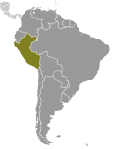 Alten Peru war Sitz der mehrere prominente Anden Zivilisationen, vor allem, dass der Inka, deren Reich wurde durch die spanischen Eroberer 1533 gefangen. 1821 Wurde die peruanische Unabhängigkeit erklärt und Nummer(n) spanischen Truppen besiegt wurden, 1824. Peru kehrte nach einem Dutzend Jahren Militärherrschaft demokratische Führung in 1980, aber erfahrene wirtschaftliche Probleme und das Wachstum der einen gewaltsamen Aufstand. Präsident Alberto FUJIMORI Wahl 1990 führte in einem Jahrzehnt, das sah eine dramatische Wende in der Wirtschaft und bedeutende Fortschritte bei der Beschneidung Guerilla-Aktivität. Dennoch zunehmende der Präsident Abhängigkeit von autoritären Maßnahmen und ein Einbruch der Konjunktur in die späten 1990er Jahre generiert Montage Unzufriedenheit mit seinem Regime, die im Jahr 2000 zu seinem Sturz führte. Eine Übergangsregierung überwachte Neuwahlen im Frühjahr 2001, die in Alejandro TOLEDO Manrique zum neuen Leiter der Regierung - hineingeführt Perus erster demokratisch gewählter Präsident indianischer Abstammung. Der Präsidentschaftswahlen 2006 sah die Rückkehr von Alan GARCIA Perez, die nach einer enttäuschenden Amtszeit als Präsident von 1985 bis 1990 eine stabile makroökonomische Leistung beaufsichtigt hat. Ehemalige Offizier Ollanta HUMALA Tasso ist im Juni 2011 Präsident, Keiko FUJIMORI Higuchi, die Tochter von Alberto FUJIMORI besiegt wurde. Seit seiner Wahl hat HUMALA auf der sound, marktorientierte Wirtschaftspolitik der drei vorhergehenden Verwaltungen durchgeführt.